Showing posts with label Map. Show all posts

Monday, November 19, 2018

#740 Neptune Day 2018

Our Fall 2018 voyage crosses two lines at the same time, the Equator and the Prime Meridian.

For a moment off the coast of Ghana, we float across latitude 0, longitude 0.

Green King Neptune, Queen Minerva, and their costumed court celebrate this maritime event by initiating a pitiful flock of first-time equator-crossers, derisively known as pollywogs 😏, thereby bestowing upon them the prestigious title Emerald Shellback.

The Royal Barber is on duty, keen for head shaving.

And of course, fish kissing is required.
Yours in enjoying maritime tradition,
Kelly

Wednesday, May 03, 2017

#725 A Very Mappy Museum

I love maps. I love museums. What if there was a museum about making maps?

We found just such a treasure at the US Geological Survey office in Rolla, Missouri.

Keith is a great guide. He knows his way around these mapping tools because he used them back in the day to create topographic maps. That makes Keith both a cartographer and historian. That's an enviable skill set.

Keith has tracked down and displayed the physical artifacts to document how mapping technology changed over time at USGS. On the second shelf from the top on the right, yes, those are 3D mapping glasses.

Way back when, I took a career test. You probably did too. Your results probably didn't come back saying you should be a "photogrammetrist".  Mine did.  But only today did I follow through. Where have you been all my life you gorgeous Kern PG2 photogrammetric plotter? Ours could have been a great life together.  You and me for eight hours a day, you creamy yellow temptress.

But when you're a rebel like me and the world says you should be a photogrammetrist, you instead take up drafting. Of course, Keith has a hands-on display for my first profession.

I didn't think it possible.  After our USGS visit, I love maps and museums even more. And oh, the gift shop...


Yours in mapping museums,
Kelly

Monday, March 31, 2014

#622 Stalking a house on the Google

So, how did we come to own this 100-year-old Arts-and-Crafts airplane bungalow?

Here's how it happened.

Once upon a time in the 1990s, Kelly and I were driving around southwest Missouri, as we do.  We spied a cool bungalow down a side street and turned towards it.  (This happens more than you might think.) And that's when we fell in love.

We are so taken with the house that we ask our nearby family to let us know if it comes on the market.  Years go by, a decade or more, and then the unimaginable happens:  Google Street View comes to Aurora, MO.

From our home computer in Charlottesville, VA, we find this image.  It is a sign in more ways than one.

Everyone knows that Google's imagery is not current, but the sign in the yard tells us the cool bungalow had recently been on the market.  We zoom in on the sign and contact the realtor to see if she has any interior photos that she'd be willing to share.  She does.  And not only that, she tells us the house had been taken off the market due to illness the previous year and it is soon to be relisted.  Another sign.

That was five years ago.

Yours in reading the signs,
Mary

Sunday, November 17, 2013

#608 Underground Buenos Aires

When Semester at Sea offers an "Urban Archeology" trip to a Buenos Aires historic district, count me in.  Of course the story starts with a map.

In 1985, a local man bought a dilapidated 200-year-old mansion in the San Telmo neighborhood with plans to rehab the property and open a restaurant.  Now the place is called El Zanjon and is considered by some to be the most important archeological site in Argentina's capital and largest city.

That's because early in the project workers discovered a sizable brick tunnel extending across the neighborhood and intersecting with another tunnel.  Matching the excavations with the 1800 city map showed two streams intersecting on this property.  The tunnels offer a glimpse at early attempts at urban flood control taking the streams underground, solving a drainage problem, and creating more buildable land in the growing city.
Yours in solving mysteries with maps,
Kelly  

Wednesday, October 30, 2013

#598 Hugging the African Coast

We keep an eye on the wave heights map when traveling on the MV Explorer.  On this map, dark blue is good.  Any other color is bad.

Heading south from Ghana to Cape Town, a small patch of green appears on the wave heights map off the Namibian coast, our first clue that rough seas are ahead. 
So Captain Kingston alters our route drastically closer to shore to avoid the higher waves and to stop in Walvis Bay, Namibia for refueling.

We hug the coast all the way to Cape Town where we arrive safely without crossing the rough seas that require tying the library books to the shelves as we've seen on previous voyages.  
Yours in smooth sailing,
Kelly

Thursday, October 24, 2013

#596 Pollywogs to Emerald Shellbacks

Crossing the Equator at the Prime Meridian is a special day for all - not just for map nerds.

For more on the ceremony of crossing the line, see Line-Crossing Ceremony.  On board the MV Explorer, we assemble a special court that includes King Neptune, Queen Minerva, and the cutest Master of Arms you ever did see.

Pollywogs (those who have never crossed the Equator) are initiated and become Emerald Shellbacks after completing just a few simple tasks.
'fish guts' dowsing
Fish kissing
Head shaving
Yours in enjoying nautical traditions,
Mary

Thursday, October 10, 2013

#589 Making room for what's important

Weeding a photocopier from the library means more space for map viewing.


Yours in making room for what's important,
Mary

Sunday, September 15, 2013

#572 Mercator Museum People


We arrive in Sint Niklaas, Belgium, a few kilometers from Antwerp, eager to see maps and globes in the Mercator Museum.   We depart not talking about maps and globes.
Mercator overlooking his museum

Our request for an English-language tour of the city's Mercator Museum results in our meeting of Eddy Maes, the museum's Conservator of Cartography.    

Eddy makes it clear we should call him Eddy.  Eddy's tour makes it clear he has a passion for cartography.
In the presence of Mercator's 1541 terrestrial globe
Upon learning of Mary's librarian tendencies, Eddy arranges a behind-the-scenes tour of the books. 
Eddy, Mary, and the books
Eddy, Mary, and the 1554 Munster Cosmographie

Upon learning of Kelly's Geographic Information Systems tendencies, Eddy arranges an introduction to Professor Philippe De Maeyer, Chair of Geography at the University of Ghent.
Kelly and Professor De Maeyer
We arrive to see Mercator's maps and globes.  We depart talking about the fantastic people.

Yours in appreciating folks drawn to maps and libraries,
Kelly

Sunday, September 08, 2013

#567 Nautical Hamburg

Hamburg's all about the waterfront.

According to Wikipedia, Hamburg has more bridges than any city and more canals than Amsterdam and Venice combined.  All this and Europe's 2nd largest port (behind Rotterdam) make Hamburg one of earth's most nautical places.

Strolling around the old city and crossing many of these bridges along historic canals, I've found two specialist bookstores devoted entirely to nautical topics.
translates to "Nautical Charts Nautical Books"

translates to "Fox's Ship Bookstore"
Of course I've done my part to spur the local economy.

Yours in supporting local bookstores,
Kelly

Thursday, March 07, 2013

#539 Size Matters

In geography, size matters.  On maps, large always wins over small.  We're human.  We're wired to quickly spot patterns and make visual comparisons.  See Tufte, Edward.

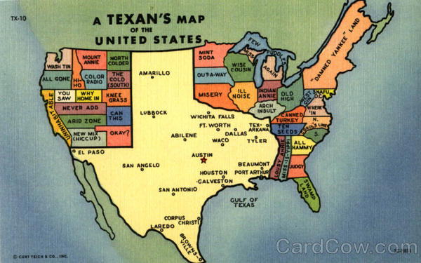
Picture a map of your own state.  How does it compare in size to the states next door, the largest states, the smallest, or Texas?

I recently joined with map-minded folks to build GeoTron 5000 to put the power of comparative geography and spatial literacy in hand.  Choose two places and the GeoTron 5000 robot spins up two maps to show exactly how those places compare.
Texas vs. Alaska

So what's going on behind the scenes in GeoTron 5000 to enable these mappy comparisons?
Natural Earth & Quantum GIS

GeoTron 5000 houses an international map library based primarily on Natural Earth, a fantastic public domain vector dataset.  The Natural Earth maps were pre-processed using Quantum GIS geographic information systems software to present consistent comparisons of land area from California to Kyrgyzstan.  International country lists and official land areas were harvested from the United Nations Statistics Division via their World Statistics Pocketbook and Demographic Yearbook.  Domestic datasets are from the US Census.

GeoTron 5000 is free at the Apple App Store and includes all 50 US States and the District of Columbia.  Additional geographies outside the USA are available for comparison via in-app purchase.  The app requires no cell service, no internet connection, and no international data plan when traveling.

Travel is one of the best tests of our spatial literacy.  When away from familiar territory we can use the size of places we know well to better understand places we've never visited.  Travel guide books assume a high degree of spatial literacy when offering comparisons like "Germany is about half the size of Texas".  But spatial thinking is best served when we choose familiar frames of reference.  For example, to understand the relative size of China's Great Wall, HowBigReally.com displays the massive wall scaled and centered over any location, here Charlottesville, Virginia:
SizeMattersHowBigReally

Visualizing comparative size and shape requires skill in spatial thinking. Packing a suitcase, parking a car, finding a restaurant, finding your car when leaving the restaurant...all involve visualizing spatial relationships based on size, distance, shape, and changing points of reference.  Artsy infographics overlay the world on Africa and popular television explores Mercator's map distortions.  We're all thinking spatially every day.
"Spatial literacy is the competent and confident use of maps, mapping, and spatial thinking to address ideas, situations, and problems within daily life, society, and the world around us." - Diana Stuart Sinton, Geographer and Spatial Thinker
Universities host spatial studies centers, organize spatial studies conferences, and offer graduate level training in spatial literacy.  And spatial literacy is a topic of growing academic focus beyond the higher ed classroom. Kids love maps.  Using maps to illustrate comparative size promotes spatial thinking at an early age.
"Spatial thinking can be learned, and it can and should be taught at all levels in the education system." - National Research Council
Much of Edward Tufte's brilliant work on visual literacy is centered around maps.  In Envisioning Information he writes of maps:

"No other method for the display of statistical information is so powerful."

Scaled maps for geographic comparison using How Big Really or GeoTron 5000 inform spatial reasoning by answering the key question: compared to what?

Size matters.

[Cross-posted with scholarslab.org]

Sunday, September 18, 2011

#518 Saint and Nation and Maps

Kelly keeps telling me he has a cool job in the Scholars' Lab.  

He's always been inquisitive, so he's energized by working with scholars from so many different disciplines who use Geographic Information Systems.  And he likes to make maps.

A few months ago, he came home with stories of his search for 17th-century political boundaries of Spain.  He'd been consulting with Erin Rowe on her forthcoming book tracking the "Spanish devotion to the cult of saints".
Now Saint and Nation is published and shelved at Alderman Library.  Four maps are bound inside. They clearly show, among other things, Spanish political boundaries from the 17th century.


Yours in agreeing Kelly has a cool job,
Mary

Friday, February 18, 2011

#467 Flexibility, Safety, and Semester At Sea

Things change quickly at sea.

Semester At Sea travelers are wise to remain flexible. Our first two SAS voyages included mid-trip itinerary changes. During Fall 2006 typhoon Shanshan intervened so we skipped a port. Summer 2008 we were on our way to Istanbul when bombings there resulted in our unexpected visit to Alexandria instead.

Now on Spring 2011, outside forces again intervene. We arrived at the entrance to Cape Town harbor yesterday right on time. But rough seas prevented the local pilot from boarding our ship and guiding us into the harbor. Now we’ve circled the harbor for 24 hours waiting for improved conditions and our harbor entry remains at the local pilot’s discretion. Safety really is a priority on Semester At Sea.
Yours in being patiently flexible,
Kelly

Friday, February 11, 2011

#462 A Hot Start in Africa

John Muir called Africa the "Hot Continent".  After our first day on the ground in equatorial Africa, we agree with John. 

Our hot Sunday walk through Takoradi's central market circle (the town's hub and spoke layout is Washington DC-like) put us face-to-face with enormous snails, live crabs, scalded pig's feet, guinea fowl, and fish in all possible forms. No photos allowed.
Clearly Sunday in Takoradi was all about the churches.  Familiar hymns like "Rock of Ages" drifted through open pointed-arch windows into bustling courtyards.  The local ladies do love to dress up for church and once services were over, they loved having their pictures taken.

Yours in enjoying a hot African start,
Kelly

Wednesday, February 02, 2011

#457 Blackwater

I grew up on the banks of the Blackwater River in Missouri.

The Blackwater was not black but muddy brown and the source of the river's name is lost to history.

Having just spent time on Brazil's black river, the Rio Negro, I was pleased to see a rare sight on the tourist map, a river that's not colored swimming pool blue, but black.

Yours in map accuracy,
Kelly